
The Great Journey of the Zambezi River
The Zambezi River’s beauty attracts visitors from all over the world, providing breathtaking wildlife viewing, water sports and adventure. Running through six countries on its way to the Indian Ocean, the Zambezi is Africa’s fourth largest River system, after the Nile, Zaire and Niger Rivers.
The length of the Zambezi River is less developed with settlements, in comparison to other major African rivers. Many stretches of the River also enjoy ‘protected’ status which allows for many populations of animal and bird to flourish as they should, and have always done. The sheer power of this mighty river has also carved out the spectacular Victoria Falls and the winding Batoka Gorge.
The Great Journey of the Zambezi
Running for a length of 2700kms, the Zambezi River begins it’s journey as a little spring in the corner of north-west Zambia. It bubbles up very close to the border where Zambia, Angola and Zaire meet. Along the way lie two major catchment areas, namely Lake Kariba (between Zimbabwe & Zambia) and Cabora Bassa Dam in Mozambique.
The Zambezi then enters Angola for about 230kms, where it accumulates the bulk of its headwater drainage, and re-enters Zambia again at Cholwezi rapids, flowing due south but substantially enlarged by the entry of various tributaries.
This upper part of the river is thinly populated by pastoralists, farmers and fishermen and although wildlife is sparse it is remarkably free of pollution. This is also the scene of the remarkable Ku-omboka Ceremony where thousands of inhabitants move annually to higher ground as the Zambezi floods into the low lying plains. It passes through the flat sandy country of the Western Province, then traverses the broad, annually flooding Barotse Plains, where much of the water is lost to evaporation, then over more rocky country where it’s tranquil course is interrupted by the Ngonye falls and rapids.
As the River turns to an easterly direction it forms the border between Zambia and Namibia and eventually joins up with the Chobe River in the Caprivi Swamps, briefly forming a border with Botswana. For the next 500kms it serves as the border between Zambia and Zimbabwe thundering over Victoria Falls and through the narrow, steadily deepening Batoka Gorge, providing a fantastic playground for white water rafting, kayaking, river boarding and jet boating. From here the steep sides of the gorge eventually flatten out at the broad Gwembe Valley.
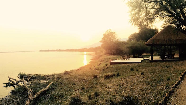
The Zambezi then flows into Lake Kariba for 281kms – it’s width at one point being 40kms. From the dam wall the river travels due north, heading east again at Chirundu. Here it is flanked by the Lower Zambezi National Park on the Zambian side and Mana Pools National Park on the Zimbabwean side. This middle zone supports one of Africa’s most important wilderness areas, and is where the Lower Zambezi Lodge has the privilege of looking out over.
After the Luangwa confluence, a much larger Zambezi flows into Mozambique, into the Cabora Bassa Dam, and then out towards the Indian Ocean, having provided power, food, pleasure and transport for many and a home for untold numbers of wildlife along it’s journey.